Lee' s Corner Cabins

Lee' s Corner Cabins

Lee' s Corner Cabins (Hanceville,Канада)

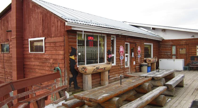
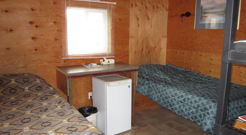
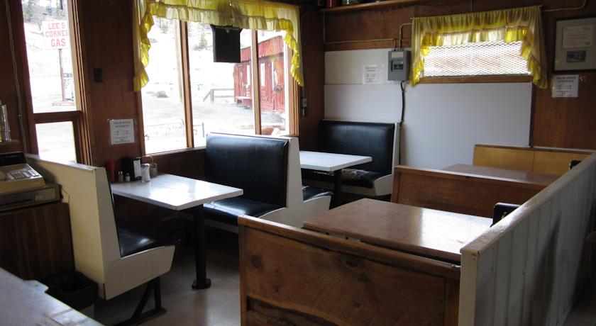
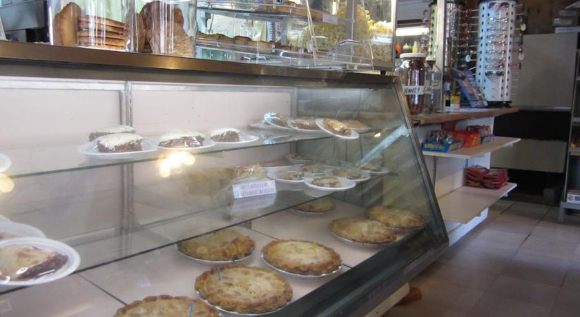
Категория отеля: 2-звездочный отель
Адрес: 6385 Hwy 20, V0l 1K0 Hanceville, Канада
Описание: Conveniently located on Highway 20, this Lee s Corner accommodation features a restaurant and a mini market. A refrigerator and a microwave are provided in all guest units. Hanceville is 6 km away.Free Wi-Fi and a flat-screen TV with satellite channels are included in each unit at Lee s Corner Cabins. An en suite bathroom offers free toiletries for added convenience.The restaurant at Lee s Corner Cabins is open for breakfast, lunch, and dinner. Menu items include omelets, sandwiches, and burgers. At the on-site market, guests can enjoy fresh, home-baked goods.A guest launderette is available at Lee s Corner Hanceville Cabins. Free parking is provided on site. A non-smoking environment is offered for added comfort.Alexis Creek is 25 minutes drive away. Williams Lake is 91 km from Lee s Corner Cabins.
Еда и питье: Ресторан (меню)
На свежем воздухе:
Парковка: Бесплатно! Бесплатная Общественная парковка на месте (предварительный заказ не требуется) .
Услуги: Мини-маркет на территории, Номера для некурящих
Спорт и отдых:
Сервис: Прачечная
Интернет: Бесплатно! Wi-Fi предоставляется в отдельных номерах отеля бесплатно.Wi-Fi предоставляется в общественных зонах по цене CAD 3 в час.
Языки общения:
Время заезда/выезда: C 15:00 / До 11:00
Домашние животные: Размещение домашних животных допускается по предварительному запросу. Данная услуга может быть платной.
Банковские карты: visa,euromastercard,
Номерной фонд: Мини-гостиница при ресторане: 4 номера
Координаты: ш. 51.9416524498909 д. -123.057681974775 на карте
 

Каталог отелей.

Игры ⚽ Поможем сделать НИР

Полезное


Смотреть что такое "Lee' s Corner Cabins" в других словарях:

  • Log cabin — For other uses, see Log cabin (disambiguation). Log cabins in the open air Norwegian Museum of Cultural History in Bygdøy, Oslo …   Wikipedia

  • National Register of Historic Places listings in Searcy County, Arkansas — Location of Searcy County in Arkansas This is a list of the National Register of Historic Places listings in Searcy County, Arkansas. This is intended to be a complete list of the properties and districts on the National Register of Historic… …   Wikipedia

  • United States — a republic in the N Western Hemisphere comprising 48 conterminous states, the District of Columbia, and Alaska in North America, and Hawaii in the N Pacific. 267,954,767; conterminous United States, 3,022,387 sq. mi. (7,827,982 sq. km); with… …   Universalium

  • performing arts — arts or skills that require public performance, as acting, singing, or dancing. [1945 50] * * * ▪ 2009 Introduction Music Classical.       The last vestiges of the Cold War seemed to thaw for a moment on Feb. 26, 2008, when the unfamiliar strains …   Universalium

  • National Register of Historic Places listings in Glacier National Park — This is a list of the National Register of Historic Places listings in Glacier National Park. This is intended to be a complete list of the properties and districts on the National Register of Historic Places in Glacier National Park, United… …   Wikipedia

  • Glossary of nautical terms — This is a glossary of nautical terms; some remain current, many date from the 17th 19th century. See also Wiktionary s nautical terms, Category:Nautical terms, and Nautical metaphors in English. Contents: A B C D E F G H I J K L M N O P Q R …   Wikipedia

  • Curry Village, California — Not to be confused with Camp Currie. Curry Village   Unincorporated community   Curry Village, Yosemite National Park …   Wikipedia

  • Meridian, Mississippi —   City   Meridian s Gateway to Downtown, the 22nd Ave Bridge …   Wikipedia

  • Taylorsville, Utah — Infobox Settlement official name = Taylorsville, Utah settlement type = City nickname = motto = imagesize = image caption = image mapsize = 250px map caption = Location of Taylorsville, Utah mapsize1 = map caption1 = subdivision type = Country… …   Wikipedia

  • Public Land Survey System — Seal of the BLM The Public Land Survey System (PLSS) is a method used in the United States to survey and identify land parcels, particularly for titles and deeds of rural, wild or undeveloped land. Its basic units of area are the township and… …   Wikipedia


Поделиться ссылкой на выделенное

Прямая ссылка:
Нажмите правой клавишей мыши и выберите «Копировать ссылку»